
Early Heatwave Hits Eastern Australia as Unseasonable Weather Spans Continent

| Peak temperature | 33°C reached in parts of Sydney |
|---|---|
| Historical record | Warmest start to spring in Sydney since 1858 |
| Fire warnings | Total fire ban declared for greater Sydney |
| Wind predictions | Gusts up to 110 km/h forecast in South Australia |
| Rainfall forecast | Up to 60 mm expected in northern Tasmania and Victoria |
Unseasonably high early-spring temperatures have swept across eastern Australia, pushing temperatures in parts of Sydney to 33 degrees Celsius on Saturday. Driven by inland winds and an intensifying El Niño pattern, the heat has prompted total fire bans in greater Sydney alongside heightened fire warnings across several states, even as other regions of the country face high winds, heavy rain, and mountain snowfall.
Unseasonal Heat Across Eastern States
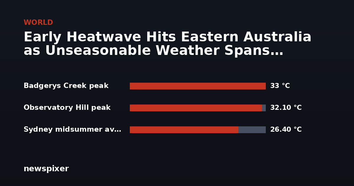
Temperatures during the opening days of September placed Sydney on track for its warmest start to spring since weather monitoring began at the city’s Observatory Hill station in 1858. Average maximums across the first five days of September neared 27 degrees Celsius, matching Sydney’s typical midsummer average of 26.4 degrees Celsius.
On Saturday afternoon, the suburb of Badgerys Creek recorded 33 degrees Celsius shortly before 2:00 p.m., while Observatory Hill reached 32.1 degrees Celsius soon after. Unusually warm conditions also extended northward into southern Queensland, where temperatures were expected to reach the mid-30s.
Meteorologist Tom Saunders explained that a gusty north-westerly airflow was transporting hot air from the interior of the continent toward the coast. Saunders stated that for Sydney, Saturday was “likely to be the hottest day this early in spring on record,” adding that spring temperatures across the region could average up to 3 degrees Celsius above recent historical baselines.
Fire Restrictions and Destructive Winds
The sudden spike in warm, dry, and windy weather significantly elevated bushfire risks across multiple regions. Authorities declared a total fire ban for greater Sydney due to extreme fire danger ratings.
Australia’s national council for fire and emergency services warned of heightened fire risks stretching across northern and southeastern New South Wales, southeast Queensland, northeastern Tasmania, South Australia, Victoria, parts of Western Australia, and broad swathes of the Northern Territory.
Meanwhile, western parts of southeastern Australia braced for damaging winds. In South Australia, gale-force gusts up to 110 kilometers per hour were forecast across the Mount Lofty and Flinders ranges from Saturday evening into Sunday, creating risks of fallen trees and structural damage.
Rain, Flood Watches, and Mountain Snow
In contrast to the coastal heat, rainfall warnings were issued for southeastern Australia. Northeastern Victoria and northern Tasmania were projected to receive up to 60 millimeters of rain. Bureau of Meteorology meteorologist David Crock pointed out that river catchments in these areas were already saturated, noting, “They’ve seen multiple rounds of flood warnings this winter already.”
In the higher elevations of southern New South Wales, live weather cameras captured snowfall at Thredbo in the Snowy Mountains on Saturday morning. The Bureau of Meteorology forecast a daytime low of -1 degree Celsius at Thredbo top station. However, Weatherzone journalist Anthony Sharwood highlighted that “the Australian snowpack is at a historic low for the first week of September,” meaning the fresh snowfall would provide little long-term accumulation following a mild winter.
Background
The sharp start to spring coincides with a powerful El Niño event active in the Pacific Ocean. On Thursday, the United Nations weather agency announced that the event continues to strengthen and is likely to persist until early 2027, warning of widespread climate impacts globally.
In Australia, El Niño episodes traditionally correspond with reduced rainfall and warmer temperatures across the southern and eastern regions during winter and spring. These atmospheric conditions substantially elevate the likelihood of prolonged heatwaves, agricultural droughts, and severe bushfire seasons.



Leave a Reply